"I often feel like I'm living in a very pleasant dream." - Genie
Mantra: bahhhhhh
Boom: This story begins like most good stories. With a pool, a huge tub of cool whip and a fire. After crossing the desert and arriving at the doorstep to the Sierra, Walker Pass, we celebrated our successful completion of the desert. The end to miles and miles of waterless stretches. The end to mountains made of sand with the only shade found under the occasional Joshua tree. We had made it! To celebrate, we chillaxed to the max at the Weldon KOA with snickers ice cream bars and a cool pool. The night before we were preparing (mostly mentally) to hike out the next day, word came down that a forest fire had been started in between Walker Pass and Kennedy Meadows (mile 652-702). The passing of dozens of fire engines down the two lane highway, along with half the sky marred by smoke confirmed the news.
I have to condense the actions we took next, but trust that significant debate and conversation led us to think about creating an alternate route around the fire. Day hike purchased a few topo maps of the area and after many hours of old school map measuring, we had come up with a suitable alternate route that was roughly equivalent in distance (but not in epicness) to the now closed PCT. Slow Magic was in.


[We take shopping very seriously; moderate excitement for coffee, group photos!; hardway eating like... 5 or 6 doughnuts; more groups pics!]
Step one of the plan was to hitch hike into Lake Isabella and then grab a bus about ten miles north to a small adventure town of Kernville, known for white water rafting and mountain biking. After stopping for donuts (it was national donut day, folks!) we took over the center square of Kernville and napped under the trees. Now, why would we be napping when we could be hiking? It’s because the high temperature of the day was 108 and we were hiking backwards up “the plunge”. This is a 7 mile section of an IMBA (Internaltional Mountain Biking Association...I am well acquainted) trail where you race down five thousand feet of elevation into the town of Kernville. The main issue is that we were doing in reverse.
Now, before we go forward in the story, I have to explain some of the thought process and dangers involved with creating our own route. Water is a huge concern. Although we were technically in the Sierras, there was no guarantee that the blue lines on our map would actually have water flowing in them. The second unknown was the condition of the trails we had chosen. The mountain biking trail woul no doubt be well traveled, but we had another 40 miles of remote trail that was a crap shoot. We chatted up the local ranger station and got a few different opinions, ranging from, “yeah, all the rivers are flowing great” to, “we are in a major drought, I wouldn’t depend on any of those sources”.
All right, so you understand our position? We were going into the Sierra backcountry with conflicting reports of water and trail quality. But we are Slow Magic, and we have been hiking for the past two months in somewhat brutal conditions. We can do this.
Our journey officially started around 5pm as we walked a couple of road miles to the mountain bike trail. Even the road walk was filled with danger and excitement as Genie tugged Fey off the side of the road to avoid a large and coiled snizzle (Dayhike trucked right by and paid no nevermind). We also posed for a group selfie that I believe is about as good as selfies can get, aside from the fact that you can only see half of Woodstock's face.


[The view as we start our climb; mayhaps the best selfie of all time; The Cannell trail!; Hardway looking good; sunset! Some extra surprises during our night hike]
So we reach the trail, which is our start, but the typical end to an epic mountain biking trail. Typically, you would fly down the last 7 miles dropping about 5000 feet of elevation in a section rightly named, "the plunge". Yes, you've figured it out by now, we were going backwards. We can skip the details, but eventually half the group made it to the top around 11PM and threw down their rucks in disgust at how badass we were. Fey and I were about 20 minutes behind the first crew, and shortly after arriving at the top DH and Genie returned from a bonus expedition exclaiming that there was no water where we were planning to stock up. Trouble. Big time trouble.
Our options were limited: find water before 7AM in order to trek on, or go back down the plunge in the morning with our heads hanging low and our mouths dry. Do you understand the stakes? All our planning, all the adventure just snuffed out after a little night hike simply because we couldn't find any stinking water!? This was unacceptable, and only one option made any sense: keep on hiking.
So, the logistics of this were immense. We were on the top of a mountain with about 2L per person and no prospect of a refill until we got back to town. Robin and myself volunteered to hike an additional ten miles to the next water source on the map to try and find that liquid gold. I kid you not, but it took more than an hour to tease out all of the options, "what happens if you find water? what happens if you don't find water? How long should the group wait if we don't hear from you? Do you have enough warm clothes to spend the night? Should you sleep a couple hours and wake up at dawn to look for water instead of at night?". You get the gist. Eventually, we took off into the darkness with Robin and myself yelling, "YO BEAR" to scare away any potential... bears.
I wish I could sit here and type out an epic journey over craggly mountain peaks led on by the sliver of a moon... but we stumbled upon water after about a mile of hiking and were back at camp within the hour. Success!
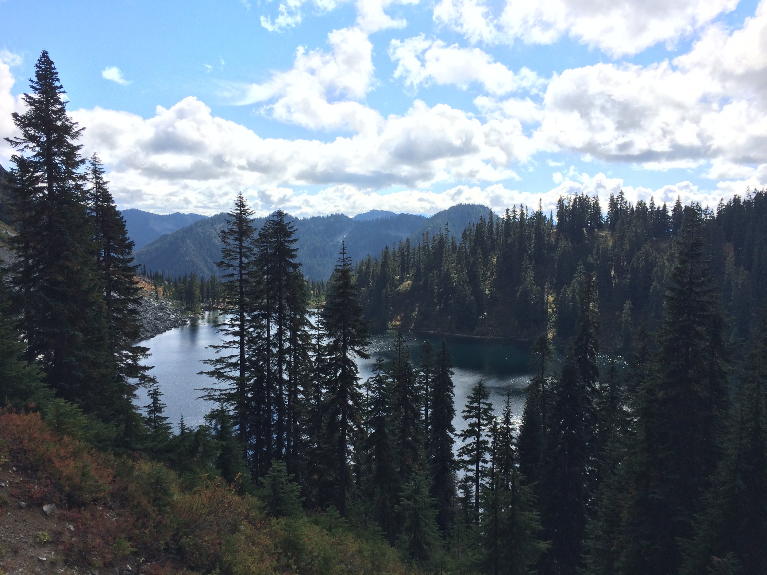
Despite a short night's sleep, we excitedly scurried on the following day and I commented multiple times on how happy I was that I got to see the trail during the day. We walked past golf course green meadows with perfect rock formations and amazing single track weaving through the woods. There is no doubt I will have to return to this trail with a mountain bike in the future. The group stayed relatively close together and we joined up at pre-determined check points whenever the possibility of getting lost made itself available. We chugged into "Big Meadow" for lunch, and it was an extremely large, extremely pretty meadow. We gazed out half expecting to see baby deer frolicking, an elk sipping from a mountain stream, and black bears roaming off in the distance. Naw, we didn't see any wildlife, but it was still picture perfect.
Since we were making up the rules on this route, some of us decided to walk across the meadow as the crow flies instead of taking the trail around. Capi led the way, picking his way through the boggy meadow until there was no option other than to run at full speed with his boots sinking deep into the mud and flinging earth all about. Naturally, we followed.
The short night's sleep had us running on empty, but we churned out another 5 miles to yet another idyllic meadow with a crystal clear spring. Slow magic will ride another day!


[Real life meadows!; stilted tree; scrumpy running through a meadow; getting the feet up; Jet performing some first aid on Animal; the view from our camping spot]
In the morning, Dayhike received a GPS text from his brother informing the group that the PCT had reopened at 6PM the night before and that we were "clear to proceed East" and pick up the PCT for the final 8 miles into Kennedy Meadows. This was awesome news and required just a small tweak to our plans in order to rejoin the PCT.
We set off from camp feeling like pros. This feeling evaporated almost instantly as the the trail that sent us East had not been a trail in some time (say... 30 years?). Well well well, the final challenge for this crew!? Challenge accepted! We estimated it would be about a 10 mile bush wack through the valley and that seemed like a solid day's task.
The group bunched up, counted off, and trudged on never getting out of eyesight. Capi and Robin set out like rangers, relaying terrain information back to DayHike who steered the rest of the group (now known as sheep due to the constant "Baaaaa" ing that seemed fitting for the occasion) through the countryside. The day was hot and the going was slow. It took us all morning to make it about 4 miles, eek. We pushed on after a lunch break and the terrain opened up a bit allowing us to make better time. We steered through the valley by aiming for major land marks and simply picking the easiest path. By late afternoon we stood on top of a ridge looking down on the Kern river with the distinctly well trod PCT laying a mile beyond. We shot down the mountain side like... goats? or sheep? or just highly motivated hikers and practically ran to the river. No time could be wasted to drop our packs, strip off our shoes and jump right on in to the refreshing mountain flow. We had made it. The PCT was a mile to the east through open brush, and we camped next to the river that evening with smiles and accomplishment in spades.
My final note is that we woke the next morning to massive bear prints throughout our camp. All campers were safe, sound, and only halfway freaked out.


[Starting out in the morning; where the trail be?; the views; Chilling after cooling off in the river; Dinner and hanging out by the Kern River]